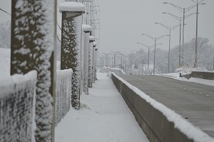
 EAST ST. LOUIS – To prepare for winter travel on Illinois roadways, State Senator Christopher Belt (D-Swansea) and State Senator Rachelle Aud Crowe (D-Glen Carbon) are reminding Metro East commuters and families of the winter road conditions map on the Getting Around Illinois website.
“Accidents are more likely when the weather creates hazardous road conditions,” Belt said. “Getting Around Illinois is a great tool to ensure people are safe and prepared when traveling during the cold winter months.”
Previously, the map displayed conditions by county. New this year, the map shows how weather events are impacting roads, including the ability to identify and zoom in to a location, travel route or destination with current information recorded by plow drivers.
“Winter weather can significantly impact road conditions, and getting reliable information to drivers is essential for safe travel,” Crowe said. “I encourage motorists to check the road conditions map when snow and freezing temperatures are expected in the Metro East.”
Individuals can interact with the map to understand how weather events are affecting roads across the state. The winter road conditions map is available on Illinois Department of Transportation’s website.